Key takeaways
- Charts, transducer and display arrive together, so there is nothing else to buy to go boating.
- Nine inches is the practical minimum for split-screen navigation plus sonar.
- Coastal coverage matches the water most U.S. buyers actually fish.
- Broad Navionics-format compatibility for adding regions later.
- Fits a flush-mounted fiberglass console without a major rework.
What Is the Best Touchscreen Marine Chartplotter With Navionics Mapping?
The Garmin ECHOMAP UHD2 94sv with the GT56 transducer and Garmin Navionics+ U.S. Coastal is the best overall touchscreen chartplotter with Navionics mapping for most coastal boaters, because it pairs a 9-inch sunlight-readable display with a genuine CHIRP sonar package and current Navionics+ chart data out of the box. It suits center consoles, walkarounds and bay boats in the 20 to 28 foot range where one screen has to handle navigation, depth and fishfinding at once. If your water is a lake rather than the coast, the UHD2 93sv with U.S. Inland charts is the same hardware with different cartography. If space and budget are tight, the 7-inch UHD2 74sv gets you the same interface for less. If you need maximum screen area for radar, autopilot overlays and multi-zone sonar, the 12-inch ECHOMAP Ultra 122sv is the premium answer. And if you already own a compatible display, a standalone Navionics chart card is the cheapest way to add mapping.
Top 3 Picks
Best overall: Garmin ECHOMAP UHD2 94sv with GT56 transducer and U.S. Coastal Navionics+ charts. The sweet spot of screen size, sonar quality and coastal coverage, and the unit most owners will never need to replace.
Best budget: Navionics Plus Regions South Marine and Lake Charts on SD/MSD. If you already have a compatible plotter, this card delivers full regional marine and lake mapping for a fraction of a new combo unit.
Best premium: Garmin ECHOMAP Ultra 122sv with GT56UHD-TM transducer and worldwide basemap. A 12-inch display with the processing headroom for radar, autopilot and live sonar modules.
Quick Comparison
| Product | Best For | Key Specs | Price Tier |
|---|---|---|---|
| Garmin ECHOMAP UHD2 94sv (GT56, Navionics+ U.S. Coastal) | Most coastal boats 20–28 ft | 9″ touchscreen, GT56 CHIRP transducer, coastal charts included | Premium |
| Garmin ECHOMAP UHD2 93sv (GT56, Navionics+ U.S. Inland) | Inland lakes and reservoirs | 9″ touchscreen, GT56 transducer, inland charts included | Premium |
| Garmin ECHOMAP UHD2 74sv (GT54, Navionics+ U.S. Coastal) | Smaller boats, tighter helms | 7″ touchscreen, GT54 transducer, coastal charts included | Mid-range |
| Navionics Plus Regions South Marine and Lake Charts (SD/MSD) | Adding charts to an existing plotter | Regional marine + lake coverage on SD/MSD card | Budget |
| Garmin ECHOMAP Ultra 122sv (GT56UHD-TM, Worldwide) | Large consoles and serious electronics packages | 12″ touchscreen, GT56UHD-TM, worldwide basemap | Premium |
| Navionics Plus Regions West Marine and Lake Charts (SD/MSD) | West coast and western lake boaters | Regional marine + lake coverage on SD/MSD card | Budget |
| Navionics Platinum+ New Zealand Marine Charts | New Zealand boaters wanting premium chart detail | Platinum+ tier NZ marine coverage on card | Budget |
| Navionics Navionic+ New Zealand Marine Charts | New Zealand boaters on the standard chart tier | Standard Navionics+ NZ marine coverage on card | Budget |
| Garmin ECHOMAP UHD2 64sv (GT54, Navionics+ U.S. Coastal) | Kayaks, tenders, small skiffs | 6″ touchscreen, GT54 transducer, coastal charts included | Mid-range |
| Garmin ECHOMAP UHD 94sv (GT56UHD-TM, U.S. BlueChart) | Buyers wanting keys plus touch on a 9″ screen | 9″ keyed-assist touchscreen, GT56UHD-TM, U.S. BlueChart | Premium |
| Garmin ECHOMAP UHD2 95sv (no transducer, Canada Inland) | Canadian inland boaters reusing an existing transducer | 9″ touchscreen, Canada inland charts, transducer not included | Mid-range |
| Garmin ECHOMAP UHD2 72sv (GT54, worldwide basemap) | Buyers who will add charts separately | 7″ touchscreen, GT54 transducer, worldwide basemap only | Mid-range |
How We Chose
This roundup was assembled from published manufacturer specifications, listing documentation and well-established facts about how each product category works, not from bench work or time on the water. The first filter was category fit: every pick here is either a touchscreen chartplotter or a Navionics-format chart product, because mixing in keypad-only plotters or proprietary non-Navionics cartography would defeat the purpose of the search. The second filter was chart compatibility. Garmin’s ECHOMAP line ships with Garmin Navionics+ or BlueChart data depending on the SKU, and the standalone Navionics cards use the SD/MSD format that a wide range of plotter brands accept. Knowing which side of that divide a unit sits on matters more than any single spec, because it determines whether you can add regions later and at what cost.
The third filter was screen size and physical fit. A 12-inch unit changes where you can mount it, how much helm space it eats and how much it draws from the electrical system. A 6-inch unit is easy to install and hard to read at speed with a split screen. We weighted the 7-inch and 9-inch classes heavily because that is where the majority of trailerable boat owners actually live. The fourth filter was sonar and networking headroom: whether a transducer is included, what class it belongs to, and whether the unit supports the modules an owner is likely to add in two or three years. The fifth was upgrade path. A unit that forces you to replace the whole display to gain radar or autopilot integration is a worse long-term purchase than one that accepts it later, even at a higher entry price.
1. Garmin ECHOMAP UHD2 94sv – Best for Coastal Boats Needing One Do-It-All Screen
As an Amazon Associate we earn from qualifying purchases at no extra cost to you.

The UHD2 94sv is the pick for anyone running a single display on a coastal boat in the 20 to 28 foot range. It combines a 9-inch touchscreen, a GT56 transducer and Garmin Navionics+ U.S. Coastal charts in one box, which means the boat is fully navigable and fish-finding on day one with no separate chart purchase. That bundling is the whole point: a first-time plotter buyer who has to separately source a transducer, a chart card and a mount quickly spends more than the difference between this unit and a cheaper one.
Screen size is the headline trade-off. Nine inches diagonal is the smallest size that still reads comfortably with a split-screen layout — chart on one half, sonar on the other — while standing at the helm of a boat that is moving. Go down to 7 inches and split-screen work gets cramped; go up to 12 and you need a console that can physically host the unit plus clearance for cables at the back. Nine inches is also small enough for a flush mount in a fiberglass dash with modest cutting, which is why it is the most common size on trailerable center consoles.
The GT56 transducer is the more capable of the two transducer classes Garmin pairs with these units. It is a CHIRP unit with multiple frequency elements, which matters for two reasons. First, lower frequencies punch deeper and hold bottom at speed; higher frequencies give finer target separation in shallow water. Having both in one housing means one hole in the transom, one cable run and no need to choose. Second, high-frequency CHIRP is what makes side and down imaging usable — those views render detail based on the higher-frequency elements, and a single-frequency traditional transducer cannot produce them at all.
| Spec | Detail |
|---|---|
| Display | 9-inch touchscreen, sunlight-readable |
| Transducer | GT56 CHIRP, multi-frequency, includes imaging elements |
| Included charts | Garmin Navionics+ U.S. Coastal |
| Mapping format | Garmin Navionics+ / Navionics-compatible cartography |
| Sonar views | Traditional CHIRP, plus imaging views supported by the transducer class |
| Typical use | Open bays, coastal nearshore, inland coastal rivers |
Pros
- Charts, transducer and display arrive together, so there is nothing else to buy to go boating.
- Nine inches is the practical minimum for split-screen navigation plus sonar.
- Coastal coverage matches the water most U.S. buyers actually fish.
- Broad Navionics-format compatibility for adding regions later.
- Fits a flush-mounted fiberglass console without a major rework.
Cons
- Premium tier pricing for a 9-inch display when 7-inch alternatives cost noticeably less.
- U.S. Coastal charts are wrong for a boat that lives on a lake or reservoir.
- Nine inches still feels small if you want chart, sonar and radar tiled at once.
- The included transducer is not the top UHD element class, so the Ultra 122sv wins on imaging detail.
Against the nearest alternative in this list, the UHD2 93sv, the difference is cartography and nothing else that matters. Same 9-inch screen, same GT56 transducer, same UHD2 interface — the 93sv just swaps U.S. Inland charts for U.S. Coastal. Buying the wrong one is the single most common mistake in this category. If your boat sees saltwater or tidal coastal rivers, take the 94sv. If it never leaves a lake or reservoir, the 93sv is the correct SKU and the one you should compare against this unit.
2. Garmin ECHOMAP UHD2 93sv – Best for Inland Lake and Reservoir Anglers

The 93sv is the inland twin of the unit above: same 9-inch touchscreen, same GT56 transducer, but Garmin Navionics+ U.S. Inland charts instead of coastal. For a bass boat, walleye rig or pontoon that never sees salt, this is the better buy simply because the chart data matches the water. Inland coverage is not a downgrade — for lakes and reservoirs it is the correct dataset, and the coastal equivalent would leave you with generalized shoreline and no lake detail at all.
Why inland anglers should care about the chart tier as much as the screen: lake fishing is structure fishing. The most valuable chart layer is high-resolution contour detail — depth curves at tight intervals — because that is what lets you find a hump, a ledge or a channel edge before you ever drop a lure. Coastal charts prioritize different information, such as channel markers, aids to navigation and tidal data. Paying premium money for a coastal chart card you will never consult is the classic inland buyer error, and the 93sv is the fix for it.
| Spec | Detail |
|---|---|
| Display | 9-inch touchscreen, sunlight-readable |
| Transducer | GT56 CHIRP, multi-frequency, includes imaging elements |
| Included charts | Garmin Navionics+ U.S. Inland |
| Best water | Lakes, reservoirs, impoundments, large rivers |
| Sonar views | Traditional CHIRP plus imaging views |
| Upgrade path | Region cards and additional Navionics-format cartography |
Pros
- Chart data is matched to inland water, so contour detail is actually usable.
- Identical hardware to the coastal 94sv, so screen and sonar quality are not compromised.
- GT56 transducer covers both deep-channel and shallow-cover sonar work.
- Nine-inch screen handles split navigation and sonar without squinting.
- Straightforward path to add coastal regions later if the boat ever moves.
Cons
- Wrong choice the moment the boat is used in saltwater or tidal coastal water.
- Premium tier price; the 7-inch 74sv does the same job for less if space is tight.
- Inland detail varies by lake, so small or uncharted waters may show less than expected.
- Not the UHD element class, so extreme imaging detail still favors the Ultra 122sv.
Compared with the 94sv it is a one-variable decision: coastal charts or inland charts. There is no performance difference to weigh. Compared with the 7-inch 74sv, the 93sv buys you two more diagonal inches and a better transducer class, and that is exactly what you are paying for. For an angler who fishes big reservoirs and wants to run a waypoint line while watching sonar on the same screen, the extra area is worth it. For someone who fishes a single small lake and mostly wants depth and a moving map, the 74sv is the more sensible spend.
3. Garmin ECHOMAP UHD2 74sv – Best for Small Boats and Tight Helms

The 74sv is the 7-inch entry to the same ecosystem, bundled with a GT54 transducer and Garmin Navionics+ U.S. Coastal charts. It exists for boats that cannot host a 9-inch display: tiller-steered skiffs, small center consoles, older hulls with a narrow dash, or any installation where a flush-mount cut is not possible and a bracket mount is the only option. A 7-inch unit bracket-mounted on a small console is unobtrusive; a 9-inch unit in the same spot blocks sightlines and gets bumped.
The GT54 versus GT56 question is the real technical distinction here, and it is a step, not a chasm. Both are CHIRP transducers with imaging capability, and both will show bottom, structure and fish arches. The GT56 class carries a more capable element set, which translates to cleaner imaging detail and better performance at the edges of the frequency range. In practice, an angler fishing a shallow bay or a mid-depth lake will find the GT54 entirely adequate; someone chasing detail in deeper water or running side imaging at speed will notice the difference. Neither transducer is a reason to change your screen size decision — decide the screen first, then accept the transducer that ships with it.
| Spec | Detail |
|---|---|
| Display | 7-inch touchscreen, sunlight-readable |
| Transducer | GT54 CHIRP, includes imaging elements |
| Included charts | Garmin Navionics+ U.S. Coastal |
| Mounting | Suits bracket mounting where flush cutting is impractical |
| Best water | Coastal nearshore, bays, small craft and tenders |
| Tier | Mid-range |
Pros
- Real CHIRP sonar and coastal Navionics+ charts at a mid-range entry point.
- Fits helms where a 9-inch or 12-inch display simply will not go.
- Light enough and small enough for bracket mounting on small consoles.
- Same UHD2 interface and chart ecosystem as the larger units, so nothing to relearn.
- Upgrade path to a larger display later without abandoning the transducer and charts.
Cons
- Split-screen navigation plus sonar is genuinely cramped at 7 inches.
- GT54 is a class below the GT56 found on the 94sv and 93sv.
- Harder to read while standing and steering in chop or bright sun.
- Not the pick if you plan to add radar, where screen real estate matters most.
The nearest alternative is the 6-inch 64sv, and the honest comparison is that 6 inches is a real compromise. At 6 inches, tiling two views means each one is roughly the size of a phone screen in landscape, and a chart with contour lines at that scale is hard to interpret at speed. The 74sv is the smallest size that still supports serious split-screen work. If your mounting space is truly limited to a 6-inch envelope, the 64sv is the answer, but do not choose it to save money and then discover you have to pan and zoom constantly to follow a route.
4. Navionics Plus Regions South Marine and Lake Charts – Best Budget Way to Add Mapping
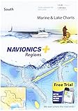
If you already own a compatible chartplotter, a standalone Navionics chart card is by far the cheapest route to real mapping. This card carries marine and lake coverage for the southern region on an SD/MSD format card, which is the physical format most plotters accept. The proposition is simple: instead of buying a new display and transducer combo, you spend budget-tier money to upgrade the unit you already have. For a boater whose current screen works fine but whose bundled basemap is too coarse, this is the highest-return purchase in the entire category.
The reason chart cards matter is that a basemap and a full chart are not the same product. A worldwide or regional basemap gives you coastline shape and major features at low resolution — enough to know roughly where you are, not enough to navigate a narrow channel or find a ledge. A Navionics-format regional card adds detailed depth contours, marked hazards, channel structure and the kind of granular detail that changes how you drive a boat. Boaters who complain that their plotter “has no detail” are almost always running on a basemap while assuming they have charts.
| Spec | Detail |
|---|---|
| Format | SD/MSD card for compatible plotters |
| Coverage | Southern region marine and lake charts |
| Tier | Navionics Plus |
| Typical buyer | Owner adding detail to an existing compatible display |
| Not included | Display, transducer, mounting hardware |
Pros
- Cheapest way to gain detailed chart coverage if you already have a compatible plotter.
- Marine and lake coverage in one card rather than two purchases.
- Standard SD/MSD format works across many plotter brands, not just one.
- No installation labor, no wiring, no transducer work.
- Easy to keep as a spare or move between boats.
Cons
- Adds no sonar, no screen and no networking — it is data only.
- Region-specific, so crossing out of the southern region defeats it.
- Requires a compatible plotter; it is useless on its own.
- Card format compatibility should be verified against your specific unit before buying.
The nearest alternative is the West region version of the same card. They are the same product tier with different geography, and picking the wrong one is the only meaningful risk. Buy by where the boat actually floats, not where you occasionally trailer it. If you split time between two regions, the correct move is two cards or a unit whose chart subscription covers more ground — not a compromise card in the hope that coverage overlaps.
5. Garmin ECHOMAP Ultra 122sv – Best Premium Pick for Large Consoles

The ECHOMAP Ultra 122sv is the top of this list for one reason: 12 inches of touchscreen with the processing and connectivity headroom to run an entire electronics package. It ships with the GT56UHD-TM transducer, which is the most capable transducer class here, and a worldwide basemap rather than a regional chart. That last detail matters — a worldwide basemap is a starting point, and most buyers will add regional chart data on top. It is a premium-tier product aimed at boats with a real dash: offshore center consoles, sportfishers, and larger cabin boats where the helm has room for a big display plus the modules it can drive.
The practical argument for 12 inches is not that the chart looks nicer. It is that a 12-inch display can tile three or four views simultaneously and keep each one legible. Chart, traditional sonar, side imaging and a radar overlay on one screen is a genuine offshore layout, and it is not achievable at 7 or 9 inches without sacrificing readability. On a boat running to distant grounds in low light or fog, that tiling is a safety and efficiency feature rather than a luxury.
The second argument is integration headroom. Larger ECHOMAP Ultra-class units are the ones with the interface capability to accept radar, autopilot, additional sonar modules and networked displays. Buying a 7-inch unit and later wanting radar means buying again. Buying the 12-inch unit once, and adding modules to it over several seasons, is usually the cheaper five-year path even though the entry price is higher. That is the real premium justification: not the screen, but the number of times you do not have to replace the display.
| Spec | Detail |
|---|---|
| Display | 12-inch touchscreen, sunlight-readable |
| Transducer | GT56UHD-TM — top transducer class in this list |
| Included charts | Worldwide basemap; regional charts added separately |
| Sonar | CHIRP plus UHD imaging views |
| Networking | Supports radar, autopilot and multi-display integration typical of the Ultra class |
| Best for | Offshore and large-console boats, multi-view layouts |
Pros
- 12-inch display makes three- and four-view layouts genuinely readable.
- Top-tier GT56UHD-TM transducer for the finest imaging detail here.
- Headroom for radar, autopilot and additional modules as the boat grows.
- Reduces the chance of replacing the display again in a few seasons.
- Worldwide basemap suits boats that cruise or ship across regions.
Cons
- Premium tier, and regional charts are an additional purchase.
- 12 inches requires substantial dash space, structural support and cable clearance.
- Higher current draw and more installation work than a 7- or 9-inch unit.
- Overkill for a small bay boat that only ever runs one screen at a time.
The nearest alternative is the 9-inch UHD2 94sv, and the comparison is almost entirely about space and ambition. If your console can host 12 inches and you intend to add radar or autopilot, the Ultra 122sv is the last plotter you will buy for this boat. If your console cannot host it, or you will never add a module, the 94sv delivers the same navigation and comparable sonar for less money and far less installation effort. Choosing the 12-inch unit “just in case” on a boat that will never carry radar is the most common premium misbuy.
6. Navionics Plus Regions West Marine and Lake Charts – Best for West Coast Boaters

This is the western counterpart to the southern card, and the same logic applies in full: budget-tier spend, real chart detail, no hardware required. West region marine and lake coverage in SD/MSD format suits boaters running the Pacific coast, western inland lakes and reservoirs, or any water inside that footprint. It is the right pick for an owner who has a working compatible display and whose complaint is missing or thin chart data rather than a failing screen.
The decision-making here is geographic, not technical. These cards differ from one another by footprint, not by capability. Before buying, check your plotter’s accepted card format and confirm which Navionics region covers the water you actually use — regional boundaries do not follow coastlines, so a boater near a boundary should verify rather than assume. If you keep the boat in one area, one card is enough. If you trailer between two regions seasonally, budget for two cards, and treat that as the true cost of the purchase.
| Spec | Detail |
|---|---|
| Format | SD/MSD card for compatible plotters |
| Coverage | West region marine and lake charts |
| Tier | Navionics Plus |
| Typical buyer | West coast or western-lake boater upgrading existing electronics |
| Not included | Display, transducer, networking |
Pros
- Lowest-cost route to detailed charts for a compatible existing plotter.
- Marine and lake detail on one card.
- Cross-brand SD/MSD compatibility in most cases.
- No wiring, cutting or installation risk.
- Simple to swap between plotters or keep as a backup.
Cons
- No sonar, no display, no networking capability.
- Wrong card if your water sits outside the west region footprint.
- Ongoing cost if you need multiple regions.
- Adds nothing if your current unit already has good regional charts.
Compared with the southern card, there is nothing to weigh beyond geography. Compared with buying a new ECHOMAP unit, the trade-off is real but simple: a card fixes your charts, a new unit fixes your charts and gives you a better screen, a transducer and module support. If your existing display is dim, unresponsive or lacks sonar, spend the money on hardware. If it is fine and only the data is weak, the card wins on value every time.
7. Navionics Platinum+ New Zealand Marine Charts – Best Premium Chart Detail for New Zealand

For boaters in New Zealand, this card is the higher-detail option: Platinum+ tier marine coverage for New Zealand waters. Platinum+ sits above the standard Navionics chart tier and is aimed at boaters who want the most detailed rendering available, typically including richer bottom composition and structure presentation and, in supported areas, additional visual overlays. If your unit already works and your complaint is that the chart looks flat and short on detail, this is the upgrade path.
New Zealand-specific coverage is the point. Global chart products often carry only generalized data for the region, and the difference between a coarse global layer and a purpose-built national chart is the difference between knowing where the coast is and knowing where the reef, the foul ground and the channel edges are. For anyone fishing or cruising around the North Island, South Island or the sounds, region-specific data is what makes the plotter genuinely useful rather than decorative.
| Spec | Detail |
|---|---|
| Format | Chart card for compatible plotters |
| Coverage | New Zealand marine |
| Tier | Platinum+ (premium chart detail) |
| Typical buyer | NZ boater wanting maximum chart detail on an existing display |
| Not included | Display, transducer, networking |
Pros
- Highest detail tier for New Zealand waters.
- Region-specific rather than a trimmed global dataset.
- Works with compatible existing plotters, so no hardware spend.
- Meaningful improvement for reef, foul ground and structure-heavy areas.
- No installation effort.
Cons
- Premium chart pricing within the budget-to-premium card scale.
- New Zealand only — useless for cruise or travel use.
- Requires a compatible display.
- The extra detail only pays off if you fish or cruise complex bottom.
Its nearest alternative in this list is the standard Navionics+ New Zealand card. That is the clean comparison: same country, same plotter compatibility, different level of chart detail. If you run a simple moving map to get from ramp to fishing ground on a well-known coastline, the standard tier is enough. If you are working ledges, foul ground and unfamiliar structure, or cruising a coastline with significant hazards, the Platinum+ tier earns its price. Do not buy the premium tier and then run it at a zoom level where the extra detail cannot render — the whole benefit is lost.
8. Navionics Navionic+ New Zealand Marine Charts – Best Standard-Tier Chart for New Zealand

This is the standard Navionics+ New Zealand marine chart card, and it is the sensible default for most New Zealand boaters with a compatible display. It delivers national coverage at the standard chart tier — the depth, hazard and channel information that navigation actually requires — without the premium-tier price of the Platinum+ version. For a boater running familiar water and using the plotter mainly for position, course and depth context, this is the value pick.
The honest framing of the two New Zealand cards is that they are not competing products; they are a step. Standard tier answers “where am I and what is the bottom doing here,” which is what most inshore and near-coastal trips need. Platinum+ answers “show me as much structure and bottom detail as the data supports,” which matters for serious fishing and complex cruising. Choose the tier by the decisions you make with the chart, not by the size of the card’s marketing claims.
| Spec | Detail |
|---|---|
| Format | Chart card for compatible plotters |
| Coverage | New Zealand marine |
| Tier | Standard Navionics+ |
| Typical buyer | NZ boater wanting dependable national coverage at standard cost |
| Not included | Display, transducer, networking |
Pros
- National New Zealand coverage at standard chart tier pricing.
- Core navigation detail: depths, hazards, channels.
- Compatible with existing plotters, so no hardware cost.
- Straightforward upgrade to Platinum+ later if needs grow.
- Zero installation work.
Cons
- Less bottom and structure detail than the Platinum+ tier.
- New Zealand only.
- Requires a compatible display to be of any use.
- No benefit if your unit already carries current NZ charts.
Against the Platinum+ card, this is purely a question of how much detail your fishing and cruising demands. Buy standard if you navigate by landmarks and depth, and premium if you hunt structure. Against buying a new chartplotter, the card is the cheap fix: it solves the data problem and leaves the hardware problem, if any, unsolved. If your screen is also due for replacement, put the card money toward a bundled unit instead — you will get charts and hardware in one purchase.
9. Garmin ECHOMAP UHD2 64sv – Best for Kayaks, Tenders and Very Small Boats

The 6-inch 64sv is the smallest unit here and the right pick when the mounting envelope is the binding constraint. Kayaks, inflatables, tenders, canoes and very small skiffs often have no dash at all — just a rail or a small flat pad — and a 6-inch display with a bracket is the largest thing that will fit without becoming a hazard. It ships with a GT54 transducer and Garmin Navionics+ U.S. Coastal charts, so it is a complete, self-contained package despite the small footprint.
Understand what 6 inches costs you before buying. A single full-screen view is perfectly usable: chart, or sonar, or a numeric data page. The compromise appears the moment you split the screen. Two tiled views at 6 inches gives each roughly the usable area of a large phone in landscape, and reading contour lines or separating fish arches at that scale takes attention you would rather spend steering. If your fishing involves following a route while watching sonar simultaneously, step up to 7 inches. If you mostly use one view at a time, 6 inches is genuinely enough.
| Spec | Detail |
|---|---|
| Display | 6-inch touchscreen, sunlight-readable |
| Transducer | GT54 CHIRP, includes imaging elements |
| Included charts | Garmin Navionics+ U.S. Coastal |
| Best for | Kayaks, tenders, canoes, minimal-dash skiffs |
| Typical use | Single-view navigation and depth finding |
| Tier | Mid-range |
Pros
- Smallest practical package with real CHIRP sonar and coastal charts included.
- Light enough for portable and rail-mounted setups.
- Same UHD2 interface as the larger units.
- Low power draw, which matters on a kayak or a small battery bank.
- Easy to remove and stow for security or transport.
Cons
- Split-screen use is a genuine compromise at this size.
- GT54 rather than the more capable GT56 class.
- Small target separation when reading sonar at speed.
- No realistic path to running radar or a large multi-view layout.
The nearest alternative is the 7-inch 74sv, and the gap between them is larger than the one-inch measurement suggests. If your boat has any flat mounting surface at all, the 74sv is the better buy. The 64sv is the correct choice when space is truly the hard limit — a kayak rail, a tender’s bench, a tiller-steered dinghy. Buy it for the footprint, not to save money, because the price difference between it and the 7-inch unit does not compensate for years of squinting at a split screen.
10. Garmin ECHOMAP UHD 94sv – Best for Boaters Who Want Physical Keys Plus Touch

The ECHOMAP UHD 94sv is the previous-generation 9-inch unit with a keyed-assist touchscreen, paired with a GT56UHD-TM transducer and U.S. BlueChart cartography. The distinction that matters is the control scheme. “Keyed-assist” means the display has physical buttons alongside the touch layer, and that is not nostalgia — it is a real ergonomic advantage in specific conditions. On a moving boat, in spray, or while wearing gloves, physical keys let you change range, mark a waypoint or adjust gain without looking down and without relying on a capacitive surface that water droplets can confuse.
The second distinction is the chart tier. U.S. BlueChart is Garmin’s own cartography rather than the Garmin Navionics+ data bundled with the UHD2 units. Both are legitimate navigation datasets, and both cover U.S. coastal water, but they are different products with different rendering conventions and different subscription and update mechanics. A buyer comparing the UHD 94sv against a UHD2 unit should treat the chart tier as a genuine decision variable, not a footnote. If you want the Navionics-format ecosystem, the UHD2 line is the direct route; if BlueChart suits your habits and you value physical keys, this unit is the one.
| Spec | Detail |
|---|---|
| Display | 9-inch keyed-assist touchscreen (touch plus physical keys) |
| Transducer | GT56UHD-TM, top-tier imaging class |
| Included charts | U.S. BlueChart |
| Control scheme | Touchscreen with button support |
| Best for | Gloved, wet or rough-water helms; BlueChart users |
| Tier | Premium |
Pros
- Physical keys remain usable with gloves on and with wet hands.
- GT56UHD-TM transducer delivers top-tier imaging detail.
- 9-inch screen supports split navigation and sonar.
- U.S. BlueChart coverage is complete for coastal navigation.
- Buttons give a reliable fallback if the touch layer is obscured.
Cons
- Previous generation relative to the UHD2 line.
- BlueChart rather than Garmin Navionics+ bundled data.
- Keyed-assist bodies are physically larger than a pure touchscreen of the same size.
- Premium price for a generation-older platform.
Its nearest alternative is the UHD2 94sv, and the comparison is generation and control scheme. The UHD2 unit brings newer hardware and Garmin Navionics+ charts; this unit brings physical keys and UHD-tier transducer performance. If you fish in cold weather, wear gloves, or run a wet boat, the keys are a genuine daily benefit and should decide it. If you want the current platform and the Navionics+ chart ecosystem, choose the UHD2. Neither is wrong — they are optimized for different helms.
11. Garmin ECHOMAP UHD2 95sv – Best for Canadian Boaters Reusing an Existing Transducer

The UHD2 95sv is a 9-inch touchscreen with Garmin Navionics+ Canada Inland charts and no transducer in the box. That last fact is a feature for a specific buyer: someone who already owns a compatible transducer from a previous install and wants to spend only on the display and charts. It is also the pragmatic choice for a boat that needs a transducer not suited to the included GT-series hardware — a through-hull or in-hull installation, for instance, where the bundled transom-mount unit would be wasted.
Buying without a transducer is only a saving if the existing one is genuinely compatible and working. Two failure modes are common. The first is a transducer from a different brand or an older generation that does not share the connector or the sonar protocol, in which case the “saving” becomes an extra purchase. The second is a physically intact but degraded transducer — a nicked cable, a fouled face, a cracked housing — which will underperform and make the new display look worse than it is. Verify both the connector and the condition before going this route.
| Spec | Detail |
|---|---|
| Display | 9-inch touchscreen, sunlight-readable |
| Transducer | Not included |
| Included charts | Garmin Navionics+ Canada Inland |
| Best for | Canadian inland boaters with a compatible existing transducer |
| Mounting | Display-only install; transducer interface depends on existing hardware |
| Tier | Mid-range |
Pros
- Lower cost than a bundled 9-inch package if you already have a compatible transducer.
- Canada Inland charts matched to the water Canadian boaters actually use.
- 9-inch screen with full split-screen capability.
- Current UHD2 platform and interface.
- Flexible for through-hull or in-hull transducer installations.
Cons
- No transducer — you must already own a compatible one or buy separately.
- An incompatible or worn existing transducer negates the saving.
- Canada Inland charts are wrong for coastal or U.S. water.
- Requires more homework before purchase than a bundled unit.
The nearest alternative is the UHD2 93sv with U.S. Inland charts and a GT56 transducer. If you are in the U.S. and need a transducer, the 93sv is the obvious pick and strictly simpler. If you are in Canada, the 95sv is the only unit here with Canadian inland cartography — which makes the comparison easy. The real decision is whether to go transducer-free, and that depends entirely on what is already installed on your transom or hull. Confirm compatibility first; the rest follows.
12. Garmin ECHOMAP UHD2 72sv – Best for Boaters Who Will Add Charts Separately

The UHD2 72sv is a 7-inch touchscreen with a GT54 transducer and a worldwide basemap rather than a regional chart bundle. It exists for the buyer who wants the hardware now and intends to buy chart coverage deliberately later — perhaps because they boat in more than one region, because they want a specific chart tier, or because they already own a Navionics card from a previous unit. It is the most flexible 7-inch option in this list and also the one that requires the most planning.
The worldwide basemap deserves a clear explanation because it is the most misunderstood spec in this category. A basemap is not a chart. It provides coastline outlines and major geographic features at a coarse scale — enough for orientation and for global use, not enough for navigation in confined water. A boater who buys this unit and stops there will have a working plotter with a poor chart. The correct expectation is: basemap included, charts purchased separately, and that second purchase should be budgeted at the time of the plotter purchase, not discovered later.
| Spec | Detail |
|---|---|
| Display | 7-inch touchscreen, sunlight-readable |
| Transducer | GT54 CHIRP, includes imaging elements |
| Included charts | Worldwide basemap only |
| Chart strategy | Regional Navionics-format cards added separately |
| Best for | Multi-region boaters and buyers with existing chart cards |
| Tier | Mid-range |
Pros
- Flexible: add exactly the chart regions you need, when you need them.
- Worldwide basemap supports orientation anywhere in the world.
- GT54 transducer and 7-inch touchscreen at mid-range cost.
- Ideal if you already own Navionics cards from a prior plotter.
- Same UHD2 interface as the larger units.
Cons
- No usable detailed chart in the box — a follow-up purchase is required.
- Basemap detail is easily mistaken for real chart data by new buyers.
- 7-inch split-screen remains cramped.
- Total cost rises once regional cards are added.
Its nearest alternative is the 74sv, which bundles U.S. Coastal Navionics+ charts and a GT54 transducer for a similar footprint. The comparison is entirely about certainty versus flexibility. The 74sv is the simpler buy: open the box, go boating, no further decisions. The 72sv is the better buy if you boat in several regions, already own chart cards, or want to choose your own chart tier. If you are buying your first plotter and boat in one place, take the 74sv — the bundled charts remove a step that many first-time buyers underestimate.
How to Choose a Touchscreen Chartplotter With Navionics Mapping
Choosing among these units comes down to six decisions, and if you make them in order, the shortlist collapses quickly. Most buyers get this wrong by starting with price and working backward, which is how people end up with a 12-inch display on a boat that cannot host it or a coastal chart card for a lake boat.
Decision 1: Screen size versus available mounting space
Screen size is the first decision because it is the least reversible. You can add charts, swap transducers and add modules, but you cannot make a mounted display bigger. Measure your mounting location before you shop, and measure it generously: a display needs its own footprint plus clearance at the back for cable bends and connectors, which typically adds an inch or more of depth that buyers forget to account for.
The practical size bands are well established. A 6-inch display supports one full-screen view comfortably and splits reluctantly — it is the size for kayaks, tenders and minimalist setups. A 7-inch display is the practical minimum for occasional split-screen use and remains easy to bracket-mount. A 9-inch display is the smallest size at which a chart-and-sonar split stays genuinely readable while standing at a moving helm, and it is the most common size on trailerable boats for exactly that reason. A 12-inch display is what you need for three or four tiled views — chart, traditional sonar, imaging and a radar overlay — and it demands a console that can support its weight and cable routing.
There is also a physical constraint that is easy to overlook on smaller boats: anything mounted on top of a console becomes an obstruction. On a tiller-steered skiff, a large bracket-mounted display blocks forward sightlines from the seated position. That is not a preference issue; it is a safety one. When in doubt on a small boat, choose the smaller display and mount it where you can see over it.
Decision 2: Which chart tier and which region
Chart data is the second decision because it is where most wasted money goes. Three questions decide it. First, what water does the boat actually use — salt or fresh, and which region? Second, does the unit ship with charts, or with a basemap that only looks like charts? Third, do you want Garmin Navionics+ data, Garmin’s BlueChart data, or a standalone Navionics card?
The coastal-versus-inland split is the single most consequential and most commonly botched choice in this category. Coastal charts prioritize aids to navigation, channel structure and tidal information. Inland charts prioritize high-resolution depth contours for lakes and reservoirs. Buying a coastal bundle for a lake boat leaves you with generalized shoreline where you wanted contour detail, and it is the kind of mistake that costs a full chart-card purchase to fix.
Region matters equally. Navionics region cards — South, West, and the New Zealand cards in this list — are geographically bounded, and boundaries do not follow coastlines neatly. Verify which region covers your water rather than assuming from the name. If you trailer between two regions seasonally, budget for two cards and treat that as part of the system cost. And do not confuse a worldwide basemap with worldwide charts: a basemap gives you coastline orientation anywhere, detailed navigation data almost nowhere.
Decision 3: Transducer class and whether you need one at all
Transducer class determines how much sonar detail you get, and it is the specification buyers most often ignore because it is invisible. The bundles here use three classes: GT54, GT56 and GT56UHD-TM, ascending in capability. All three are CHIRP units with imaging elements; the higher classes carry more capable element sets, which shows up as cleaner imaging detail and better performance at the edges of the frequency range. For shallow-water fishing in a bay or a mid-depth lake, a GT54 is entirely adequate. For deeper water or serious imaging work, the GT56 classes are worth the step up.
The more important question is whether you need a bundled transducer at all. Buying a display without a transducer only saves money if you already own a compatible, healthy unit. Two things to verify: the connector and sonar protocol must match the new display, and the existing transducer must be in good condition — check the cable for nicks, inspect the housing for cracks and clean the face of any fouling. A degraded transducer will make a new display perform worse than the old one, and the diagnosis is confusing because the display is new. If you cannot verify compatibility, buy the bundled version.
Decision 4: Networking, modules and the upgrade path
This is the decision that determines your five-year cost, and it is the one that separates a good purchase from a cheap one. A plotter that can accept radar, autopilot and additional sonar modules later lets you build the system in stages. A plotter that cannot forces a full replacement the first time you want to add anything. The larger, Ultra-class units in this list are the ones with the headroom for that kind of expansion; the 6-inch and 7-inch units are not realistic hosts for radar regardless of what their spec sheets list.
Do the arithmetic honestly. A 7-inch unit now plus a 12-inch unit in three years costs more than a 12-inch unit now. A 12-inch unit that never hosts a single module costs more than a 9-inch unit that does everything you needed. The question is not “what is the biggest screen I can afford” but “what will this boat’s electronics look like in four seasons, and will this display still be the right one?” If the answer is “the same as today,” buy for today. If the answer involves radar or a second station, buy the headroom now.
Decision 5: Sunlight readability and control scheme
Every unit in this list is described as sunlight-readable, and that is the baseline expectation rather than a differentiator. What actually varies in the real world is control scheme. A pure touchscreen is fast and uncluttered, but water droplets on the surface can register as inputs, and gloves defeat it entirely. A keyed-assist display like the ECHOMAP UHD 94sv pairs touch with physical buttons, which remains usable with wet hands, in spray, and while wearing gloves for cold-weather fishing.
Match the control scheme to the helm. If you fish in warm weather, mostly bare-handed, and boat in sheltered water, touch-only is faster and cleaner. If you fish cold mornings in gloves, run a wet boat, or operate in spray, the physical keys are a daily benefit that outweighs the cleaner look of a touch-only panel. This is the single most personal decision in the whole process, and it is the one most buyers never consciously make.
Decision 6: Budget tier and total system cost
Price tiers here fall into three rough bands. Budget tier covers standalone Navionics chart cards, which add data to hardware you already own. Mid-range covers 6-inch and 7-inch displays and the display-only 9-inch unit. Premium covers the bundled 9-inch and 12-inch packages with top-tier transducers.
The mistake is comparing entry prices instead of system prices. A chart card plus your existing plotter may beat a new bundled unit — unless your existing display is dim, slow or lacks sonar, in which case you have paid for data and still need hardware. A mid-range 7-inch bundle may beat a premium 9-inch bundle — unless you plan to run radar, in which case the 7-inch is a place-holder. Price the whole system you intend to end up with, then pick the entry point that gets you there with the fewest replacements. That single habit prevents the most expensive error in this category: buying the same capability twice.
Frequently Asked Questions
Is Garmin Navionics+ the same as a Navionics chart card?
They are related but not identical. Garmin Navionics+ is the chart data bundled with certain Garmin ECHOMAP units, provided in Garmin’s Navionics-compatible format. Standalone Navionics cards, such as the Plus Regions cards and the New Zealand cards in this list, are physical SD/MSD media that work across a wider range of compatible plotter brands. If you want the broadest hardware compatibility, a card is the more flexible route; if you are buying a Garmin bundle, the included Navionics+ data covers the same regional water.
Will a Navionics card work in a Garmin chartplotter?
Garmin’s ECHOMAP units are built around Navionics-format cartography, so Navionics data is the natural fit for them. The practical caution is that card format, region and generation all matter, and compatibility should be verified against your specific unit before purchase. The safe approach is to buy a card whose region matches your water and whose format matches the slot your display accepts, rather than assuming any Navionics card works in any plotter.
Do I need a transducer if I only want navigation?
No. A chartplotter functions as a navigation display without any sonar input — it will show your position, heading, route and chart data on its own. A transducer adds depth, bottom structure and fishfinding, which is why most bundled packages include one. If you navigate only and never want sonar, the display-only UHD2 95sv is the logical pick, and you can add sonar later if your needs change.
What is the difference between a basemap and a chart?
A basemap is a coarse global layer covering coastlines and major features — enough for orientation, not enough for navigation in confined or shallow water. A chart is detailed regional data with depth contours, hazards, channels and aids to navigation. The UHD2 72sv ships with a worldwide basemap, which is why its description explicitly notes that charts are added separately. Boaters who think their plotter “has no detail” are usually running a basemap and assuming it is a chart.
How do I choose between 7-inch and 9-inch displays?
Choose by whether you need split-screen work. A single full-screen view — chart, or sonar, or a data page — is comfortable at both sizes. The moment you tile two views, 7 inches becomes cramped and 9 inches stays readable while standing at a moving helm. If your fishing involves following a route while watching sonar simultaneously, 9 inches is the practical minimum. If you mostly use one view at a time and mounting space is limited, 7 inches is sufficient and easier to install.
Is a keyed-assist touchscreen better than touch-only?
It depends on your conditions, not on the technology being newer. Keyed-assist displays pair a touchscreen with physical buttons, which remain usable with wet hands, in spray and while wearing gloves — a real advantage for cold-weather fishing and wet boats. Touch-only displays are faster and cleaner in warm, sheltered, bare-handed use. Neither is universally superior; match the control scheme to how you actually operate the boat.
Can I add radar or autopilot to a smaller chartplotter later?
Realistically, no — not to the 6-inch and 7-inch units. Running radar and autopilot integration properly requires the screen area and interface headroom found in larger ECHOMAP Ultra-class displays like the 122sv. If you expect to add modules within a few seasons, buying a small display now and a large one later costs more than buying the large display once. Decide on the four-season plan before you commit to a screen size.
How much mounting clearance does a chartplotter need beyond its screen size?
More than most buyers allow. A flush mount requires a cutout matching the unit’s body, plus structural support behind the dash. A bracket mount needs the display’s footprint plus clearance at the rear for cable bends and connectors — typically an inch or more of extra depth that is easy to overlook. On small consoles, also check forward sightlines from the seated or standing helming position, since a display mounted too high becomes an obstruction rather than an aid.
Final Recommendations by Situation
If you run a coastal boat in the 20 to 28 foot range and want one purchase that covers everything: the Garmin ECHOMAP UHD2 94sv with GT56 and U.S. Coastal Navionics+ charts. It is the most balanced combination of screen, sonar and cartography in this list.
If your boat lives on a lake or reservoir: the UHD2 93sv with U.S. Inland charts. Identical hardware to the coastal unit, with chart data matched to the water you actually fish.
If your mounting space is tight or your boat is small: the UHD2 74sv if you have room for 7 inches, and the 64sv only if you genuinely cannot fit it. Size down for the footprint, not for the price.
If you already own a compatible plotter and only lack chart detail: a standalone Navionics Plus regional card — South, West, or one of the New Zealand cards — is the cheapest meaningful upgrade available. Match the region to your water and verify card format first.
If you plan to add radar, autopilot or multiple views: the ECHOMAP Ultra 122sv. The 12-inch screen and module headroom mean you buy the display once instead of replacing it when the electronics package grows.
If you fish cold mornings in gloves or run a wet boat: the ECHOMAP UHD 94sv with its keyed-assist touchscreen. Physical keys are a daily working benefit that a cleaner touch-only panel cannot replace.
If you are in New Zealand: the standard Navionics+ New Zealand card for dependable national coverage, or the Platinum+ New Zealand card if you work reef, foul ground and complex structure and want the highest chart detail available.